Oneida River
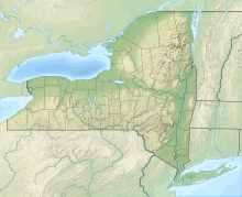
River in New York, United StatesThe Oneida River is a river that forms a portion of the boundary between Oswego and Onondaga counties in central New York. The river flows 18 miles (29 km) from Oneida Lake's outlet to its confluence with the Seneca River, where the two rivers combine to form the Oswego River that empties into Lake Ontario.
Read article
Top Questions
AI generatedMore questions
Nearby Places

Phoenix, New York
Village in New York, United States

Seneca River (New York)
River in Upstate New York

St. John's Episcopal Church (Phoenix, New York)
Historic church in New York, United States

Sweet Memorial Building
United States historic place

Northrup-Gilbert House
Historic house in New York, United States
Phoenix Central School District
School district in the U.S. state of New York
Lost World Museum
Creationist museum in Phoenix, New York
Radisson, New York
Census-designated place in New York, United States


